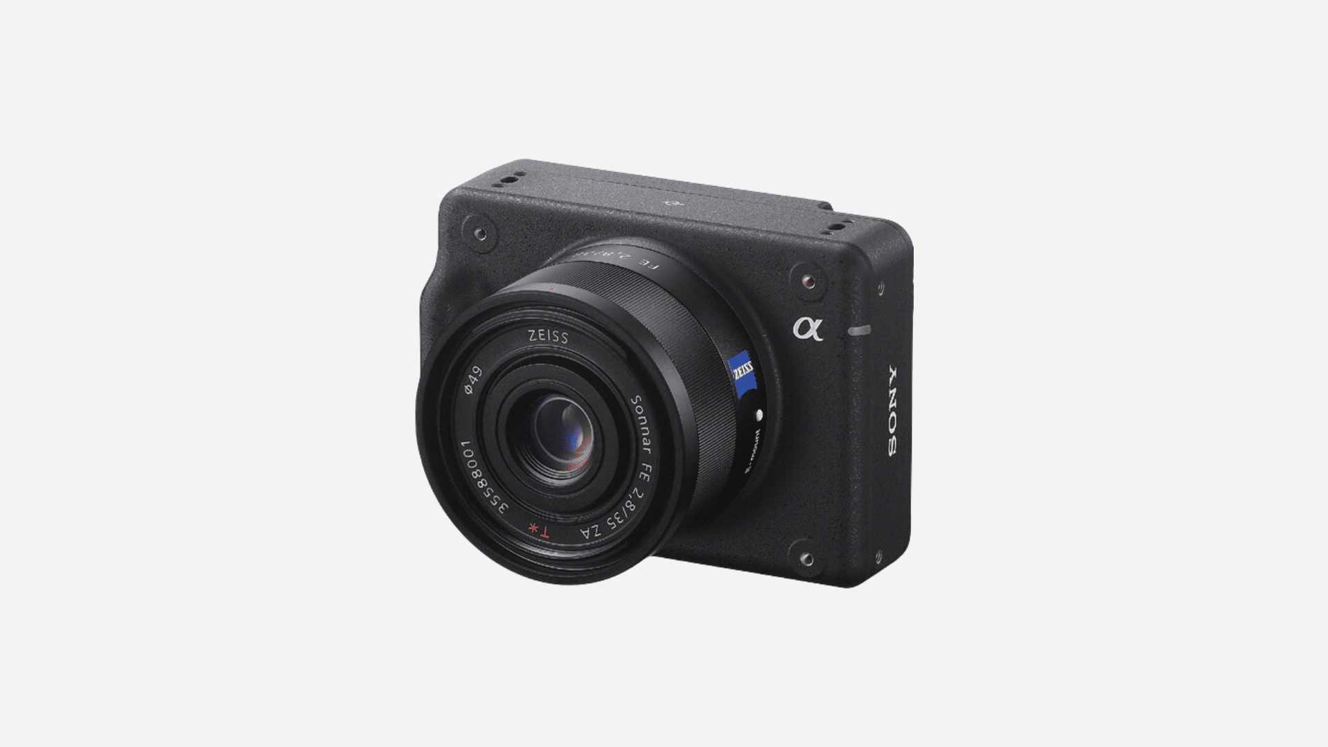
Sony’s ILX-LR1 was designed with aerial applications in mind. Inside is a 61-megapixel full-frame sensor capable of capturing fine detail from significant distances. Combined with optics tailored to these missions, crews can cover more ground per flight while maintaining the resolution needed to identify visible asset conditions such as corrosion, damaged hardware, vegetation encroachment, and other surface anomalies.
For Censys workflows, this means:
- Covering and capturing data across more acres and miles than a multirotor
- Maintaining consistent detail even when flying higher or faster
- Producing visual records that remain useful long after initial collection
In most cases, clients require both levels of insight:
- Detailed, comprehensive inspection for condition-based assessment
- High-level overview for broader situational awareness
Each serves a distinct purpose, and both are critical to an effective asset management strategy. The ILX-LR1 enables both.
Optimized for Endurance Aircraft and Corridor-Scale Missions
The ILX-LR1 was designed without a viewfinder, external monitor, or internal battery. This lightweight, compact form factor makes it well suited for endurance aircraft operating across long corridors and distributed infrastructure networks.
Direct power and control integration allow the camera to be powered from the aircraft system, supporting continuous operation without manual battery changes. This aligns with Censys mission profiles that prioritize repeatability, uptime, and reduced operational friction.
When paired with appropriate lenses, whether wide-angle or medium telephoto, the ILX-LR1 supports safe, remote inspection of energized assets while maintaining image clarity and consistency.
Seamless Integration for Control and Data Workflow Alignment
The Sony ILX-LR1 supports external camera control, allowing pilots and operators to remotely adjust settings without landing. Within Censys operations, this capability enables camera parameters to be tied directly to flight plans, ensuring consistency across multiple missions and inspection cycles.
Censys Use Cases Powered by Sony ILX-LR1 Imagery
The Sony ILX-LR1 sees widespread deployment across customer missions without modification, enabling RGB imagery workflows to scale across asset types and operational scenarios. Pre-configured capture settings and repeatable outputs simplify the process of identifying field conditions, contextualizing issues, and creating deliverables that withstand internal review, regulatory scrutiny, and long-term asset management needs.
Vegetation Management
RGB imagery validates vegetation conditions and clearance efforts. When documented properly, before-and-after imagery helps asset owners identify risk areas, prioritize work, and gain stakeholder alignment.
Transmission, Distribution & Linear Assets
High-resolution imagery enables analysts to identify visible asset deficiencies, confirm encroachments, and detect changes that may have occurred since previous inspections—without relying on isolated spot checks or ground-only reviews.
Wildfire Risk Assessments
Capture RGB imagery at scale to identify vegetation density, terrain features, asset proximity, and visible risk factors while keeping crews out of harm’s way.
Roads & Public Works
Use high-resolution RGB data to confirm project progress, validate claims, identify visible deficiencies, and assess future maintenance needs against a consistent baseline.
The value extends beyond high-resolution photography. It comes from producing data that can identify issues, support decisions, and withstand the test of time across multiple layers of organizational review.
Future-Proof Imagery for Today’s Programs
Utilities and transportation authorities face growing pressure from inspectors and regulators to inspect assets more frequently, with greater scrutiny and stronger documentation. They require fast, repeatable access to high-resolution RGB imagery they can depend on.
With proven resolution, endurance-optimized integration, and consistent capture at scale, the Sony ILX-LR1 delivers what today’s inspection programs need – issue identification, prioritization, and defensible records built for the future.
About Censys Technologies
Censys Technologies helps utilities, transportation agencies, and infrastructure operators turn aerial data into operational decisions. Through long-range BVLOS aircraft, autonomous dock networks, and analytics platforms, Censys enables persistent aerial intelligence at corridor scale.
Schedule a technical briefing to explore how high-resolution RGB and LiDAR data can support your asset management strategy.
Leave a Reply