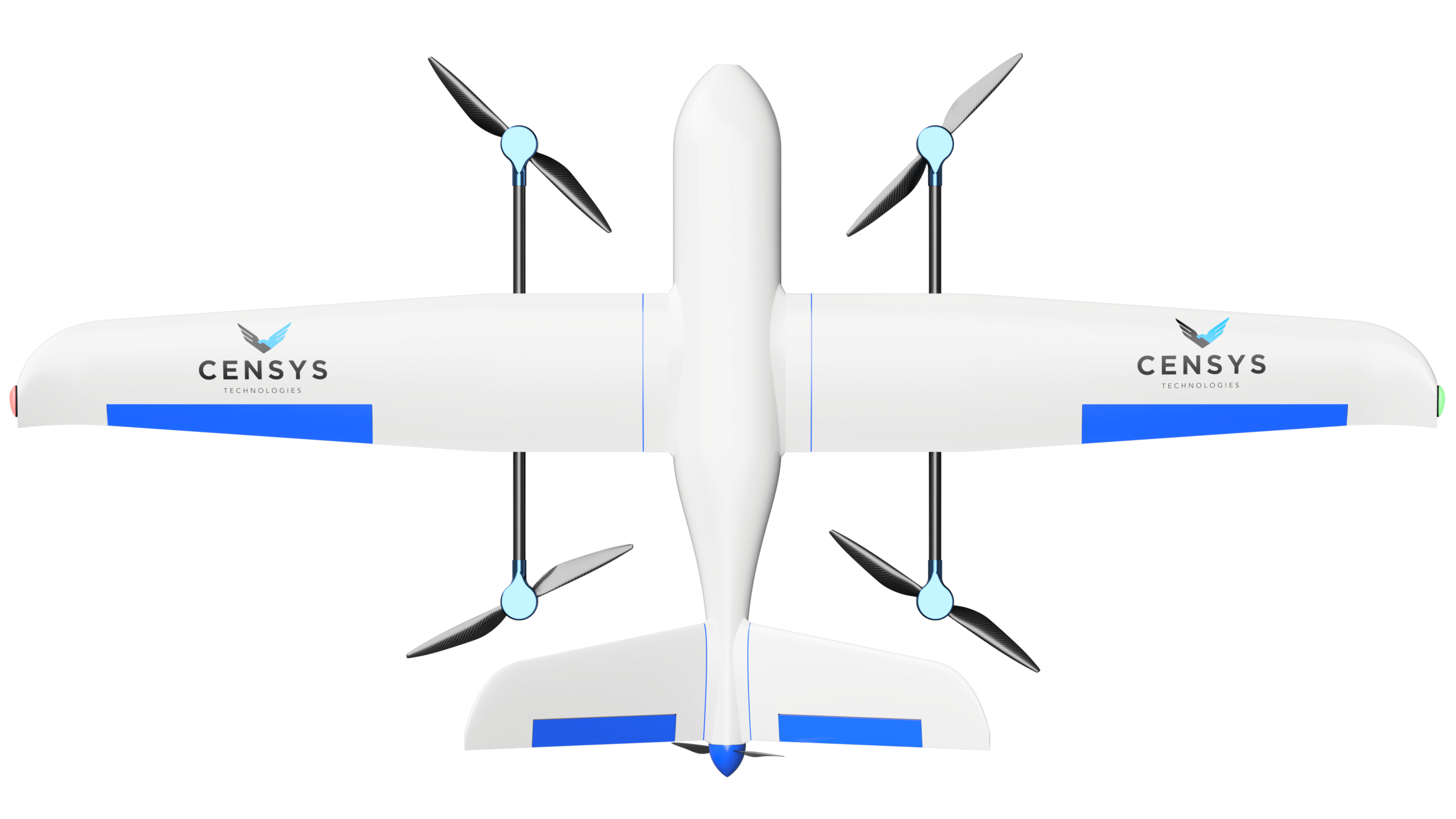
Mapping and Surveying

Map more, map better, map with the Sentaero! Capture over 600 acres of data in a single flight with incredible quality. 

Payload Abilities

Sony A6400 35mm
Payload: Sony A6400 35mm
Flight Time: 1hr
Acres Mapped: 180 acres
GSD: 1.32 cm/pxl
AGL: 390 ft
Speed: 40 mph
Overlay: 70%
Sony A7RIII 55mm
Payload: Sony A7RIII 55mm
Flight Time: 1hr
Acres Mapped: 168 acres
GSD: 0.98 cm/pxl
AGL: 390 ft
Speed: 40 mph
Overlay: 70%
 

Sony A7RIII 28mm

Payload: Sony A7RIII 28mm
Flight Time: 1hr
Acres Mapped: 408 acres
GSD: 2.07 cm/pxl
AGL: 390 ft
Speed: 40 mph
Overlay: 70%


Sony A6400 55mm
Payload: Sony A6400 55mm
Flight Time: 1hr
Acres Mapped: 117 acres
GSD: 0.84 cm/pxl
AGL: 390 ft
Speed: 40 mph
Overlay: 70%
Phase One IXM 80mm
Payload: Phase One IXM 80mm
Flight Time: 1hr
Acres Mapped: 174 acres
GSD: 0.68 cm/pxl
AGL: 390 ft
Speed: 40 mph
Overlay: 70%

The major difference, that sets our platform apart from other drone in its class is our flight time. In a single flight, you can cover and capture over 2 square miles of data with a sub 2cm ground sampling distance or better (payload dependent). Our goal is to save you time by cutting hours and days of projects while helping your business succeed financially.

Are you looking for a specific payload that is not listed above? Our research and development team can integrate almost any payload you want to be compatible with our system. 

Looking to learn more? Let’s start a conversation today!


Contact Us

1808 Concept Ct Suite 200, Daytona Beach, FL 32114

(386) 314-7829

info@censystech.com