

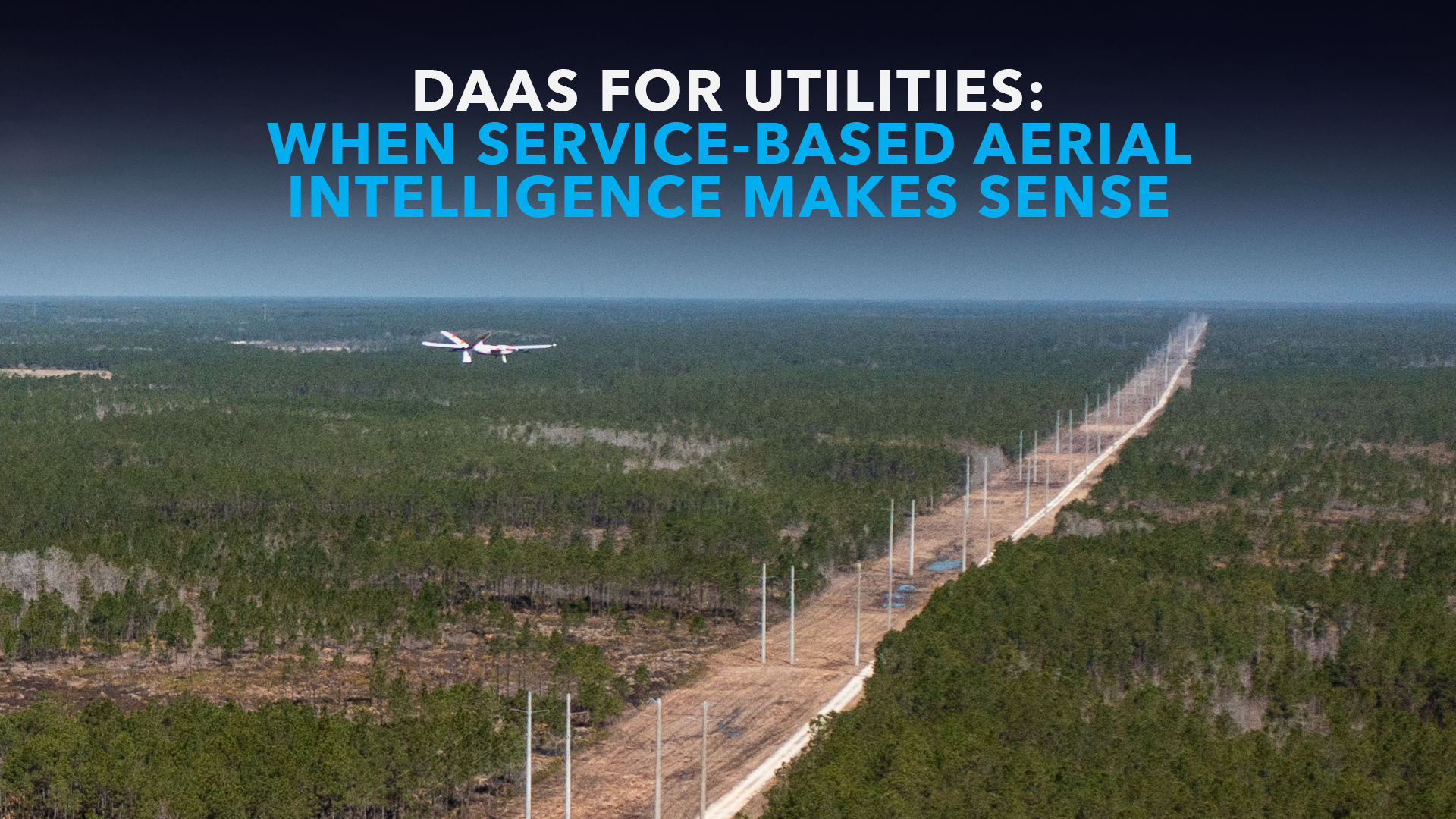
In May 2026, Censys Technologies conducted a two-day BVLOS proof of concept for a regional electric utility in central Ohio. Across six flights, the Sentaero 6 covered 158 total miles while collecting LiDAR and RGB data across transmission, distribution, and service-line infrastructure. A one-mile dataset processed through CensWise identified 54 vegetation encroachment detections through automated analysis and manual review.
The mission showed what Drone-as-a-Service can deliver when utilities need actionable intelligence fast. Instead of building an aviation program from scratch, the utility received turnkey flight operations, BVLOS-capable data acquisition, and processed findings tied directly to vegetation risk.
That result leads to a practical question for operations leaders “When does Drone-as-a-Service create the fastest path from aerial data to maintenance action?”
For many utilities, DaaS stands out when the priority is fast time-to-value, predictable operating expense, and access to proven BVLOS workflows without the burden of aircraft ownership, staffing, and regulatory approvals.
What does drone as a service include for utilities?
Drone as a service, or DaaS, is a turnkey model built around outcomes. Instead of buying aircraft, payloads, software, vehicles, and support infrastructure, a utility contracts for the result it needs, whether that is an inspection report, classified data set, digital twin, or prioritized list of assets requiring attention.
A full DaaS program can include:
- Aircraft and payload selection
- Certified remote pilots and flight crews
- Mission planning and field operations
- Maintenance and equipment readiness
- BVLOS approvals support and regulatory compliance
- LiDAR, RGB, thermal, or multispectral data collection
- Data processing and analysis
- Dashboards and actionable deliverables
Censys’s Drones as a Service offering is built around this complete workflow. The company owns, operates, and maintains the equipment, while the utility receives the intelligence needed to improve asset management and reliability through the added intelligence layer of CensWise.
This shifts the buying decision from “Which drone should be purchased?” to “Which operational outcome needs to improve, and how quickly can it be delivered?”
When does DaaS make the most sense?
DaaS makes the most sense when a utility needs results quickly without building the full operating stack itself.
Large LiDAR corridor surveys are a strong example. A utility may need highly accurate data across hundreds of miles for vegetation management, clearance analysis, asset modeling, or wildfire mitigation, but it may not need a LiDAR-equipped aircraft, specialized crew, and processing workflow running year-round. In those cases, DaaS delivers the mission as a service and shortens time-to-value.
The same is true for BVLOS-scale corridor work. A fixed wing drone with vertical takeoff and landing capability can cover long linear routes more efficiently than a small multirotor that requires frequent repositioning. These missions also involve launch and recovery planning, airspace coordination, weather, and heavy data handling. DaaS gives the utility access to that capability through a turnkey provider with established BVLOS experience.
DaaS can also provide surge capacity during emergencies. After a hurricane, wildfire, ice storm, or other major events, the need for aerial visibility can spike quickly. A service provider can bring aircraft, crews, and processing capacity online without forcing the utility to maintain a large permanent fleet for occasional peaks.
When are in-house or hybrid models relevant?
An in-house program can make sense when inspections happen frequently, and the utility benefits from immediate access to aircraft and personnel. Routine substation inspections, recurring structure checks, post-storm assessments, and daily right-of-way monitoring may fit internal teams well. Internal personnel also build institutional knowledge of local assets and operating conditions.
Hybrid models can also be practical. Internal teams can handle daily inspections and immediate responses, while a DaaS provider supports long-range BVLOS missions, large LiDAR mapping projects, high-risk corridors, or seasonal demand. A Censys utility client in Ohio offers a useful example of this mixed approach through public references to internal drone operations in Ohio and scalable grid inspection activities in Texas.
Still, the DaaS comparison matters most when utilities want to avoid the operational lift of hiring and training pilots, maintaining aircraft, managing payloads, building workflows, and navigating aviation regulations. Even in a hybrid model, DaaS creates value by extending capability quickly without requiring every layer to be built internally.
What does the economics of DaaS look like?
The financial case for DaaS begins with capital avoidance and expands into operational efficiency and faster time-to-value.
As a planning benchmark, drone-based corridor inspections can cost approximately $200 per mile. Contract helicopter patrol, by comparison, can run upwards of $3,500 per flight hour once you account for the aircraft, crew, specialized sensors, and mobilization. Actual pricing varies by mission complexity, geography, and reporting requirements, but the gap shows how utilities can use DaaS to reduce inspection spend dramatically while still gaining the transmission and distribution visibility they need.
An internal program can become more economical over time, but only when annual utilization is high enough. Planning models often place the break-even period for an internal program at 14 to 24 months, assuming the utility inspects roughly 500 to 800 miles or more per year. Below that threshold, DaaS is usually the smarter spend: the utility avoids underused equipment, specialized staffing, and ongoing maintenance costs while still getting access to a proven, turnkey operation.
The more important financial question is not simply, “What does the flight cost?” It is, “How quickly can the utility identify a risk, prioritize it, and resolve it?” DaaS becomes compelling when it lowers deployment costs and shortens the delay between data capture and decision-making.
What operational burden does DaaS remove?
Managing an aviation program can pull time and budget away from the utility’s core responsibility of keeping the grid safe, reliable, and available.
- DaaS can reduce the burden associated with:
- Aircraft procurement and lifecycle management
- Pilot staffing and training
- Payload integration
- Preventive maintenance and repairs
- Flight planning and field logistics
- Regulatory documentation
- Data storage and processing
- Software development and model management
BVLOS operations add another layer of complexity. Under the current regulatory framework, many commercial BVLOS utility inspection missions require a Part 107 waiver, including a waiver of the visual line of sight requirement. A BVLOS waiver requires an operation-specific safety case that addresses airspace awareness, lost-link procedures, ground risk, pilot qualifications, and other mitigations. Utilities evaluating long-range inspection programs can also review the FAA’s Beyond Visual Line of Sight operations guidance for broader context on how BVLOS operations are evolving.
Censys brings certified personnel, proven safety protocols, and experience supporting more than 98 FAA approvals to this process. That experience can help utilities move from concept to operation without starting the regulatory process alone. For utilities evaluating DaaS, this is a core part of the value proposition because the operational framework and BVLOS experience are already in place.
How do aircraft and data capabilities affect the decision?
The aircraft must match the geography and the data requirement, but in a DaaS model the more important point is what those capabilities deliver.
For long linear infrastructure, a fixed wing drone with VTOL capability offers efficient forward flight and flexible launch and recovery. The Sentaero 6 is designed for Over the Horizon BVLOS operations, with up to two hours of endurance, a published range of up to 90 miles, and a maximum wind capability of 30 mph. Through DaaS, utilities can access that long-range platform capability without purchasing and operating it themselves.
The platform supports payloads for LiDAR, RGB, EO/IR, and multispectral collection. A utility can use LiDAR to model terrain, vegetation, structures, and clearances, while RGB imagery provides visual context and verification. Thermal or EO/IR payloads can support pole-top thermography and targeted asset assessments.
Data collection is only one part of the workflow. CensWise processes data from aerial and other mobile sensors, helping utilities move from raw imagery and point clouds to classified findings, dashboards, and prioritized actions. That AI-enabled intelligence layer is central to the DaaS value proposition because it turns flight activity into usable operational insight.
What questions should a utility ask before choosing DaaS?
Before selecting an operating model, utility leaders should evaluate several practical factors:
- How often will the aircraft be used?: High-frequency routine missions may support an internal program. Occasional specialized missions may favor DaaS.
- How many miles or assets require inspection each year?: Annual volume helps determine whether internal ownership can reach an appropriate utilization rate.
- How quickly does the utility need results?: If the requirement is immediate post-storm response, internal crews may be essential. If the requirement is a large seasonal survey, DaaS may provide faster scale.
- What sensors and deliverables are required?: LiDAR, thermal, RGB, and multispectral missions involve different equipment and processing needs.
- What is the utility’s appetite for regulatory lift? A Part 107 waiver and BVLOS program require documented procedures, risk analysis, training, and ongoing compliance.
- Where should the budget sit?: DaaS can reduce capital requirements and create more predictable operating costs.
- Can the organization act on the data?: A successful program should connect aerial collection to work orders, vegetation management, outage prevention, and maintenance planning.
How should utilities begin?
A proof of concept can provide a practical DaaS entry point. A representative corridor helps the utility evaluate cost per mile, data quality, inspection speed, processing time, and the usefulness of final deliverables without first committing to a full internal buildout.
The central Ohio mission offers a relevant example. Six flights produced 158 miles of operational coverage, 220GB of raw data, and a vegetation analysis workflow that identified 54 detections in a one-mile processed dataset. Those results show both the potential and the operational realities of corridor-scale BVLOS work, while also showing how quickly a service-based model can move from flight operations to actionable findings.
Utilities can review the central Ohio BVLOS utility inspection case study and compare the approach with their own inspection priorities.
Is drone as a service right for your utility?
DaaS makes the most sense when a utility needs specialized capability, long-range coverage, rapid scale, or emergency capacity without taking on the full cost and responsibility of owning an aviation program.
In-house operations remain valuable for frequent inspections, local knowledge, and immediate response. Hybrid models can also play a role. Still, the core advantage of DaaS is clear: turnkey operations, BVLOS experience already in place, access to advanced aircraft and sensors, an OpEx-friendly buying model, and the CensWise intelligence layer that helps shorten the distance from data capture to maintenance action.
The right answer begins with the mission and the outcome, not the aircraft.
To evaluate the best path for a specific network, schedule a conversation with our BVLOS experts. What inspection challenges is your utility currently trying to solve, and where could Drone-as-a-Service help reduce risk, cost, or time to action?